Research Portal
A directory of open access Convex Seascape Survey research resources. Here you can download our latest publications and explore our data - from environmental, biological and historical datasets, to maps and photographs, all are uploaded and stored in freely accessible online repositories. We believe in a transparent approach as we advance knowledge in this rapidly-evolving field of blue carbon science.

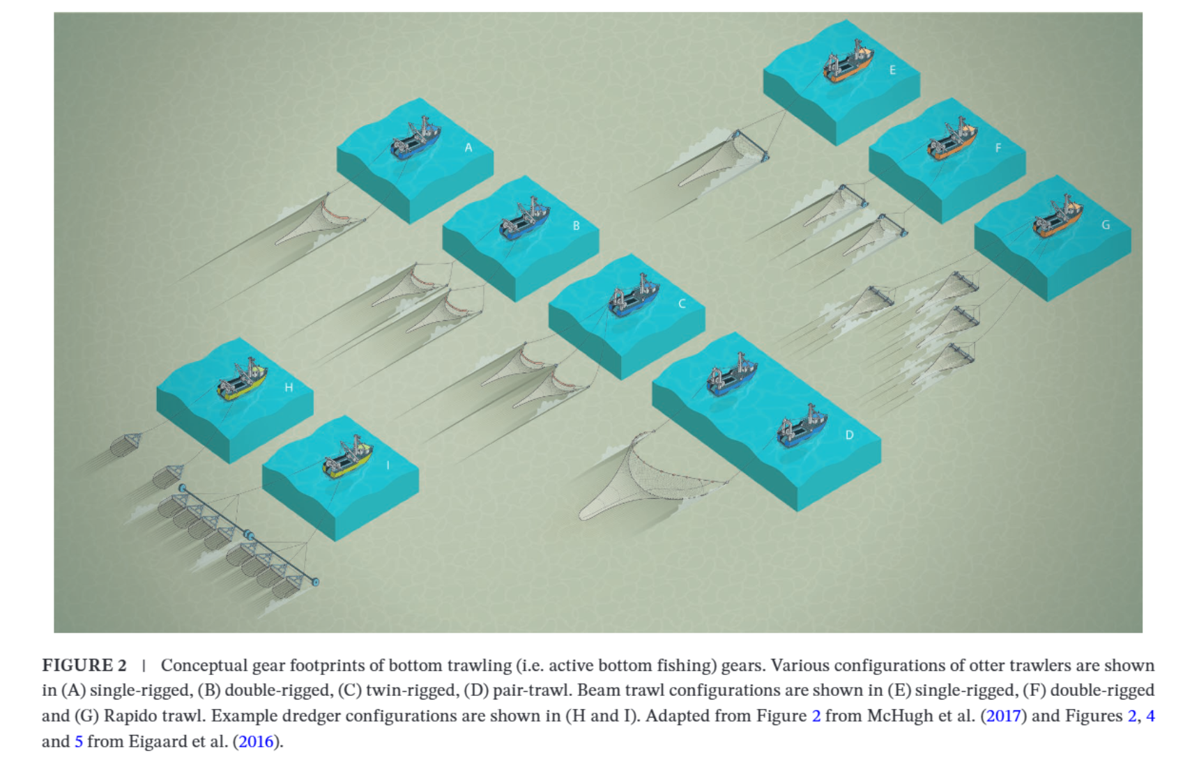
Regional variation in active bottom-contacting gear footprints
Fishing with active bottom-contacting gears (here collectively described as ‘bottom trawling’) is considered the greatest source of anthropogenic disturbance to marine sediments. However, uncertainties are apparent in studies evaluating the severity of their impacts from fishing with these gears at the global scale. A major uncertainty is the estimation of the area of seabed disturbed by applying European-based vessel size to gear footprint (i.e., gear width) relationships to the global fleet, thereby assuming these relations hold worldwide. To test the strength of this assumption, we conducted a structured review to understand global variation in fishing gear parameters and, thus, footprint of bottom trawling gears. While we find a…
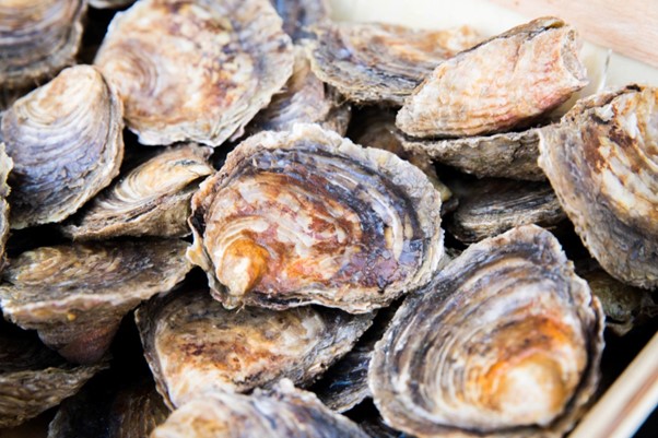
European native oyster reef ecosystems are universally collapsed
Oyster reefs are often referred to as the temperate functional equivalent of coral reefs. Yet evidence for this analogy was lacking for the European native species Ostrea edulis. Historical data provide a unique opportunity to develop a robust definition for this ecosystem type, confirm that O. edulis are large-scale biogenic reef builders, and assess its current conservation status. Today, O. edulis occur as scattered individuals or, rarely, as dense clumps over a few m2. Yet historically, O. edulis reef ecosystems persisted at large scales (several km2), with individual reefs within the ecosystems present at the scale of several hectares. Using the IUCN Red List of Ecosystems Framework, we conclude the European…
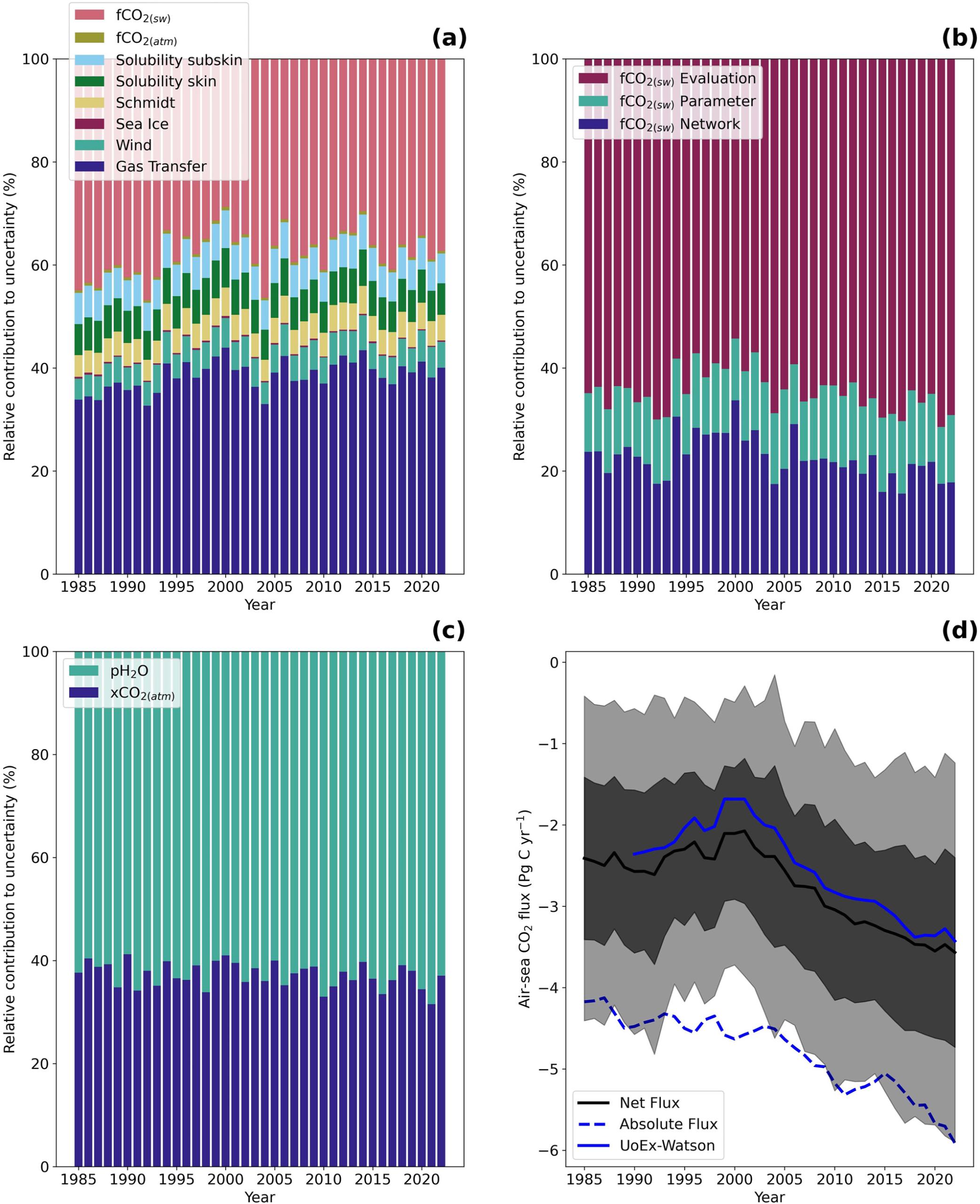
A comprehensive analysis of air-sea CO2 flux uncertainties constructed from surface ocean data products
Increasing anthropogenic CO2 emissions to the atmosphere are partially sequestered into the global oceans through the air-sea exchange of CO2 and its subsequent movement to depth, commonly referred to as the global ocean carbon sink. Quantifying this ocean carbon sink provides a key component for closing the global carbon budget, which is used to inform and guide policy decisions. These estimates are typically accompanied by an uncertainty budget built by selecting what are perceived as critical uncertainty components based on selective experimentation. However, there is a growing realization that these budgets are incomplete and may be underestimated, which limits their power as a…
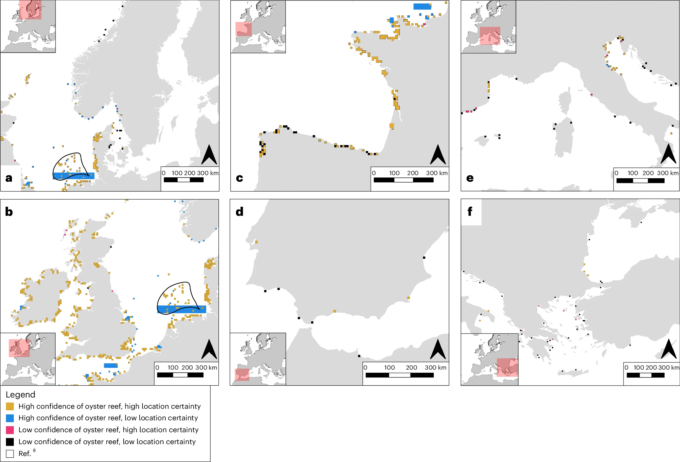
Records reveal the vast historical extent of European oyster reef ecosystems
Anthropogenic activities have impacted marine ecosystems at extraordinary scales. Biogenic reef ecosystems built by the European flat oyster (Ostrea edulis) typically declined before scientific monitoring. The past form and extent of these habitats thus remains unknown, with such information potentially providing valuable perspectives for current management and policy. Collating >1,600 records published over 350 years, we created a map of historical oyster reef presence at the resolution of 10 km2 across its biogeographic range, including documenting abundant reef habitats along the coasts of France, Denmark, Ireland and the United Kingdom…