Research Portal
A directory of open access Convex Seascape Survey research resources. Here you can download our latest publications and explore our data - from environmental, biological and historical datasets, to maps and photographs, all are uploaded and stored in freely accessible online repositories. We believe in a transparent approach as we advance knowledge in this rapidly-evolving field of blue carbon science.

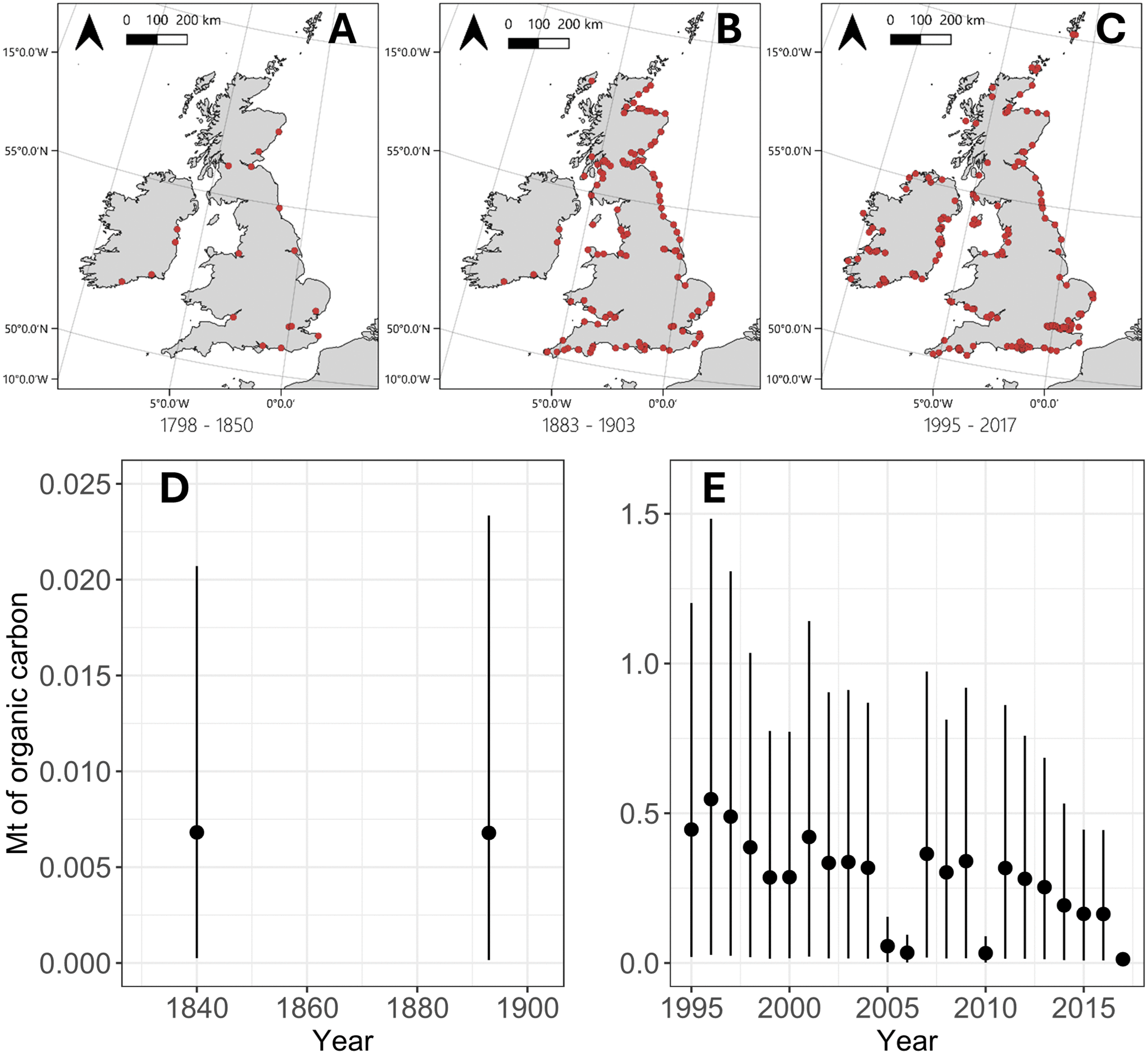
Estimating historic seabed carbon disturbance by port dredging and aggregate extraction in NW Europe
The extent to which different human activities disturb seabed carbon, the largest long-term organic carbon reservoir on the planet, is poorly understood. Research to date has focused primarily on bottom trawl fisheries, but industries that target and extract marine sediments are likely to disturb significant masses of sedimentary organic carbon. This can lead to its remineralisation and reduce the capacity of the ocean to absorb atmospheric CO2. In this study, we combine archival documents, industry records, and published seabed substrate data, to estimate historical disturbance of sedimentary organic carbon on the Northwest European Shelf (NWES) from port dredging activities and marine aggregate…
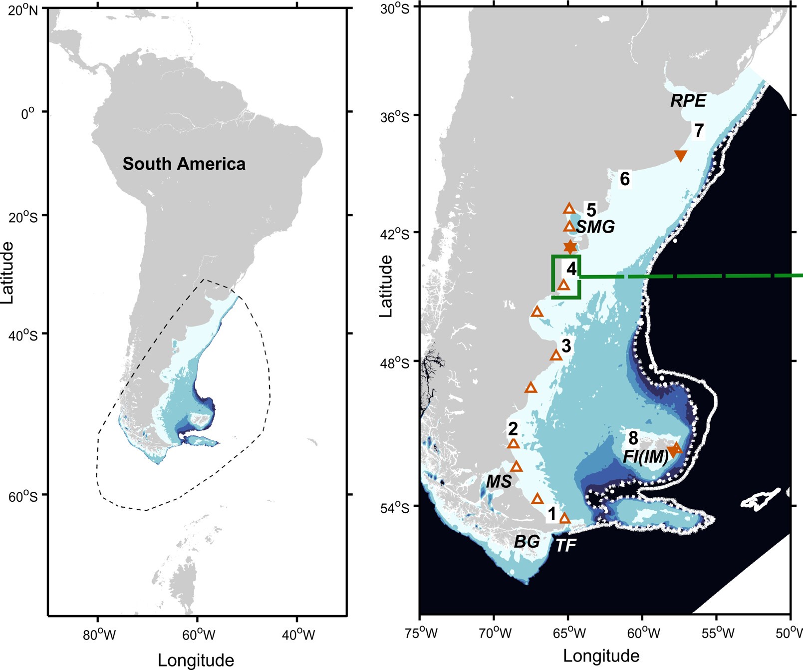
Relative Sea‐Level Change, Tidal Evolution and Energy Dissipation Across the Patagonian Shelf Since the Last Glacial Maximum
Tides play a key role in regulating shelf-sea environments, influencing sediment dynamics, habitat distribution, long-term carbon burial, coastal hazards, and water quality, with important socio-economic consequences. Yet the long-term evolution of shelf sea tides in response to sea-level change remains poorly understood. We have developed the first regional paleotidal reconstruction for the Patagonian Shelf, one of the most tidally energetic regions globally, supporting high primary productivity and sustaining rich food webs. The model incorporates updated relative sea-level reconstructions and is driven by global paleo-ocean forcing. Tidally modulated parameters are produced at 1,000-year intervals from the Last…
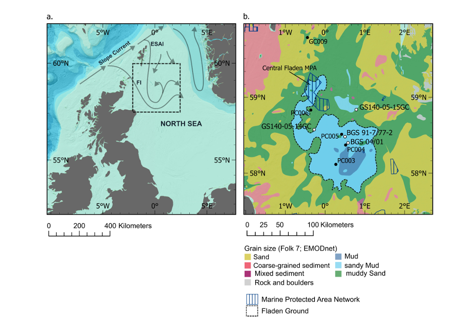
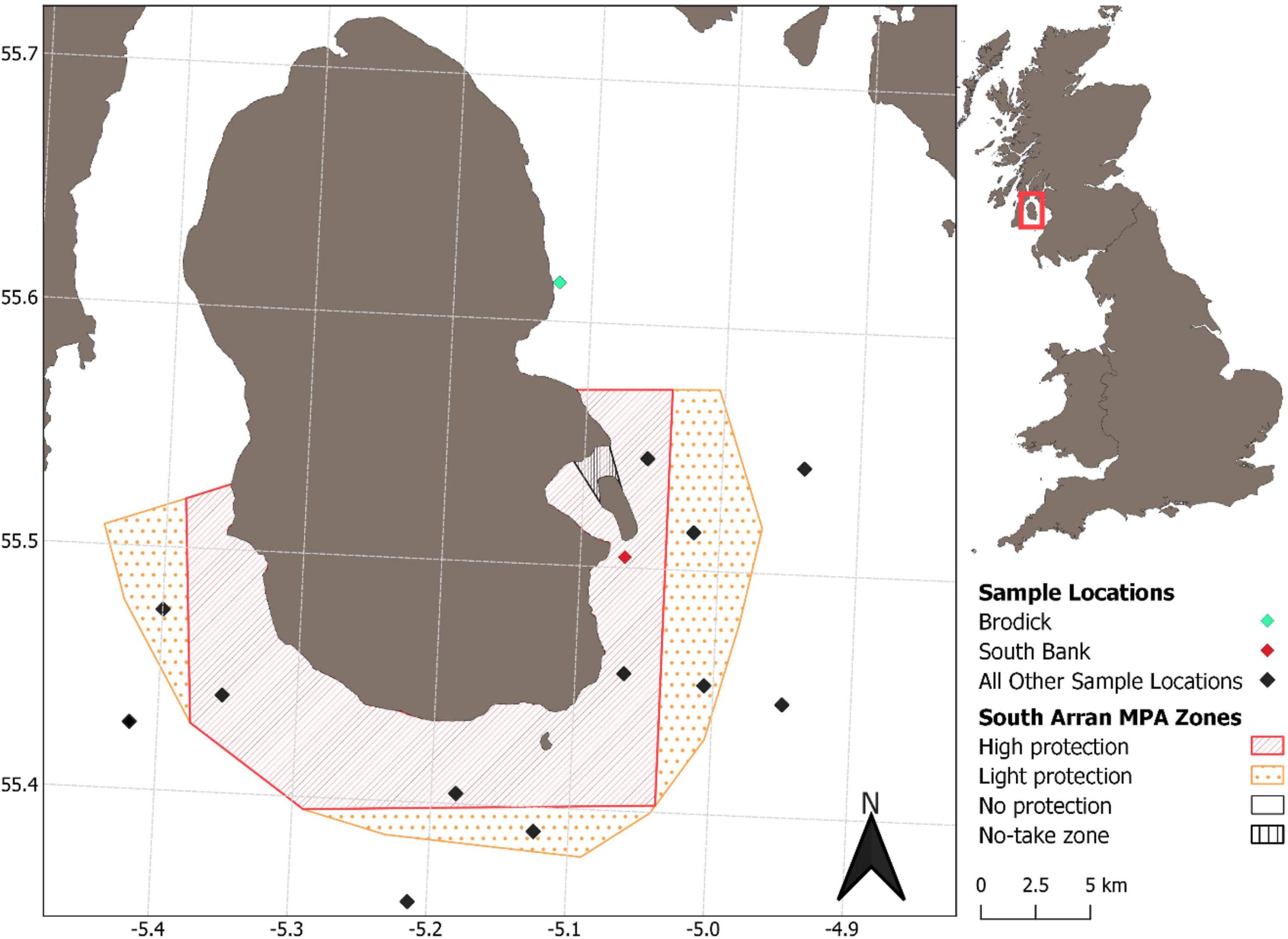
Disentangling effects of protection on seabed organic carbon and biodiversity in a rare highly protected mud-dominated MPA
Soft sediment habitats on the European shelf have endured centuries of bottom trawling, causing major biodiversity loss and long-term degradation. Due to sustained value to commercial fisheries and perceptions of low biodiversity value, they have been overlooked in the designation of MPAs. Recently, the role these habitats and their ecological communities may play in carbon storage has emerged as a compelling argument for strict protection. We investigated the effects of seabed protection on biodiversity and sediment organic carbon (OC) in a rare, highly protected, mud dominated MPA, the South Arran Marine Protected Area. Despite the challenge of confounding environmental variables inherent to coastal…
Vulnerability of blue carbon stocks to disturbance in sediments with low burial efficiency
Continental shelf sediments – particularly soft, muddy habitats – serve as significant reservoirs of organic carbon over glacial-interglacial timescales and are subject to disturbance, notably from mobile bottom fishing gear. The quantity and quality of accumulated organic carbon varies across shelf environments, with muds storing more organic carbon than other substrate types. For effective marine management, it has been recommended that the reactivity, or ‘quality’, of organic matter should be considered when assessing the vulnerability of sedimentary carbon to disturbance. If management interventions are to be made to protect vulnerable organic carbon reservoirs on the seafloor, then it is also important to consider the…